Geokaun Mountain
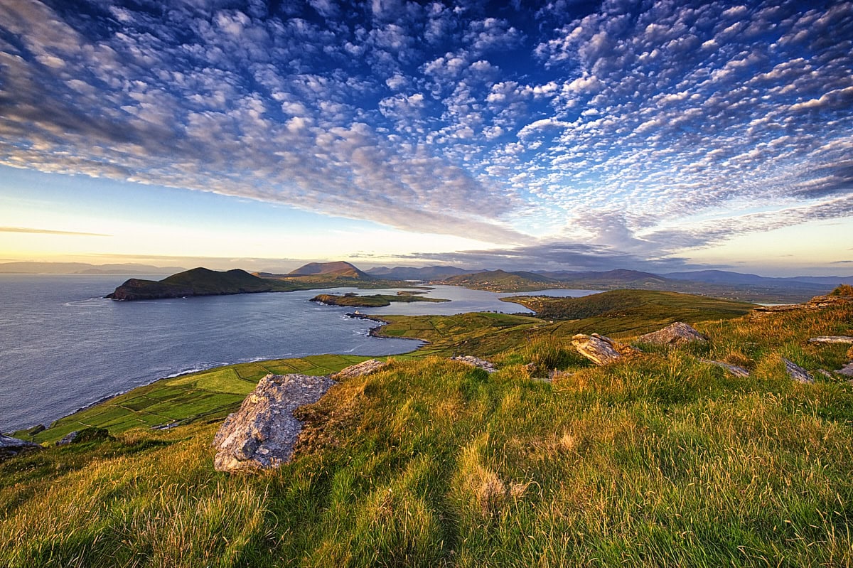
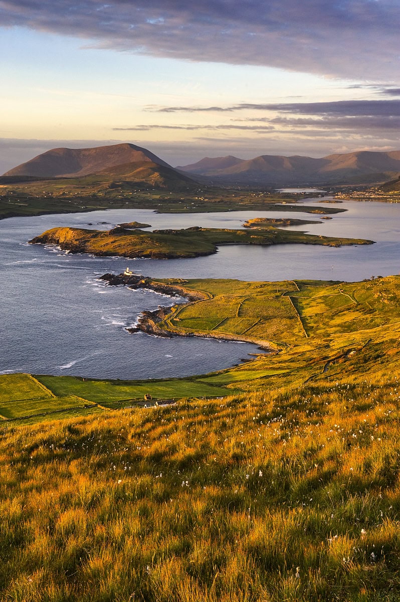
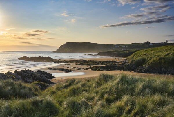
Geokaun Mountain, the highest peak on Valentia Island, offers some of the most spectacular views in all of Ireland. From the mountaintop, the view stretches across the Atlantic to the Blasket Islands archipelago and the two Skellig Islands, jutting out of the sea like rugged cliffs. My favorite view, though, is the one facing the mainland. From up here, the bay below almost resembles a fjord. Right in the middle lies the small Beginish Island next to Valentia Island lighthouse. The panorama is framed by the mountain backdrop in the distance. A view that impressively captures the essence of the Irish landscape.
Muiris and Bernie O’Donoghue, who own the land on which Geokaun Mountain is located, have developed the mountain, making it accessible to visitors. A path leads up to the viewpoint at the summit. Halfway up, a trail branches off to a viewing platform at the Fogher Cliffs. Both spots are great for taking photos.
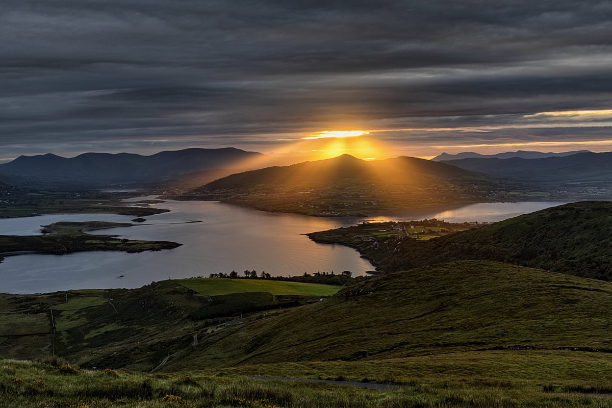
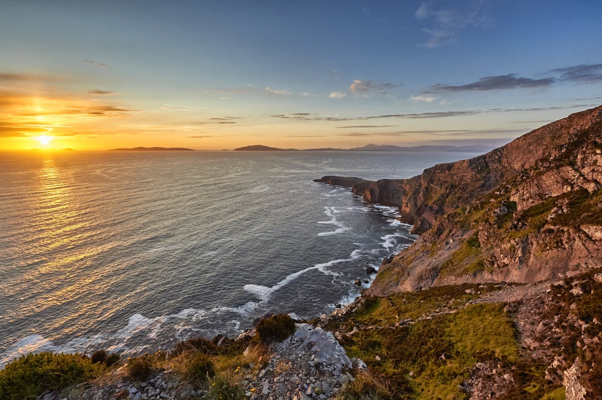
The Fogher Cliffs fall steeply to the sea on the western flank of Geokaun Mountain. The sunlight first touches the cliffs in the early afternoon. This is something to keep in mind when planning a visit. Anyway, the most beautiful light shines on the cliffs in the evening, making them glow reddish in the sunset. Also, the summit is an ideal spot for sunsets. However, thanks to the 360-degree view, a visit is worthwhile at any time of day.
For me, an ideal photo session begins about two and a half hours before sunset at the summit. The golden hour and the sunset itself are best experienced at the Fogher Cliffs, before heading back up to the mountain peak.
And if you’re staying overnight on Valentia Island, you might as well greet the sunrise from the summit of Geokaun Mountain the very next morning.
Location
In the north of Valentia Island, around 6 km from Knightstown, Co. Kerry, Ireland (Maps)
Photo opportunities
Cliffs and Irish landscape in panoramic format.
Best time
In the evening and at sunset.
Photo equipment
Camera, 14–24 mm and 24–70 mm lenses, polarising filter, graduated neutral density filter, tripod.
Tips
If you plan to take photos both from the summit and at the cliffs around sunset, it makes sense to drive to the respective car parks.
Parking
There is a car park at the base of the mountain (Maps). Further car parks are available at Fogher Cliffs (Maps) and at the summit (Maps).
A parking fee must be paid at the ticket machine at the entrance (Maps). The site is open 24 hours a day.
Distance
It depends on where you choose to park. If you drive to the two upper car parks, it is only a few metres to the photo spots. If you park at the base of the mountain, it is a circular walk of around 4.5 km with an elevation gain of approximately 150 metres.
Stay nearby
On Valentia Island or on the mainland in Portmagee.
Related posts
Hi I’m Stefan
On my blog, I take you along on my travels, write about photo locations, and share insights into my work as a landscape photographer.
Stay in touch
Subscribe to my email newsletter to get updates: